The Tongariro crossing has got to be the best walk on the North Island !

Quote from the official site " The Tongariro National Park is rich in cultural identity, it has dramatic scenery and unique land forms this combines to make the Tongariro Alpine Crossing a world-renowned trek. (Rated as the best one day trek in New Zealand and listed by many in the top 10 day treks in the world) Many who complete the 19.5 kilometre journey will tell you the climbs can be steep and the weather can be unpredictable. You will need to arrange transport to the beginning of the Tongariro Alpine Crossing track and a pick up at the end of the day."
I think something like 70 000 people do it each year .
Recently they changed the name to the "Tongariro Alpine crossing " , adding the word "alpine" to help people understand that it can be dangerous and people have died up there from exposure .
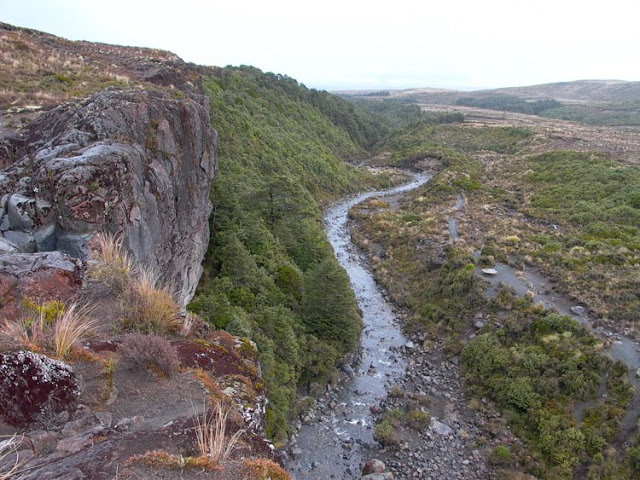
My first crossing involved first walking from the Chateaux to Mangetepopo hut which took 2 1/2 hours and had me starting about 15 minutes into the beginning of the track . In the picture at the top of this page you can see the little cluster of buildings where I started and then to the left is the hut along that black track which is close to the beginning of the walk [ at the end of that road on the left ] .
 And the Mangetepopo hut


 That's a view looking back to the top of the first climb when you start walking across the crater .

As I kept moving it was so misty that I never even noticed Blue lake when I walked past it - I have pictures of it in my later expeditions , including some in the snow .
After the Blue lake you start working your way down to the Ketetahi hut .
 The scenery is quite good there but the walk down that hill is long and tedious . It is a total of 19.5 km long but that last bit gets you - steps and downhill for 1 1/2 hours [ Last time I ran it in 48 minutes but I had a 15 kg pack ]

 When you get to the end there is a shelter as you wait for the buses to arrive . All around the area in just about every town there is an outfit offering transport for the Tongariro Crossing - they drop you off in the morning and then start arriving from around 3 pm to collect you . Since it was rated at 5-7 hours I did it in a hurry and got to the end in 3 1/2 hours and ended up having to wait for quite a few hours for the bus to arrive .
As the day wears on the bodies start lining up under the shelter .
 Back then there was still a guy in an old truck that used to turn up and sell hot dogs and coffee and cool-drinks and pies and the people all swarmed toward him as he popped out the sign advertising food . Apparently he was told he couldn't do it any more but it sure was handy !
Quote from the official site " The Tongariro National Park is rich in cultural identity, it has dramatic scenery and unique land forms this combines to make the Tongariro Alpine Crossing a world-renowned trek. (Rated as the best one day trek in New Zealand and listed by many in the top 10 day treks in the world) Many who complete the 19.5 kilometre journey will tell you the climbs can be steep and the weather can be unpredictable. You will need to arrange transport to the beginning of the Tongariro Alpine Crossing track and a pick up at the end of the day."
I think something like 70 000 people do it each year .
Recently they changed the name to the "Tongariro Alpine crossing " , adding the word "alpine" to help people understand that it can be dangerous and people have died up there from exposure .
My first crossing involved first walking from the Chateaux to Mangetepopo hut which took 2 1/2 hours and had me starting about 15 minutes into the beginning of the track . In the picture at the top of this page you can see the little cluster of buildings where I started and then to the left is the hut along that black track which is close to the beginning of the walk [ at the end of that road on the left ] .
And the Mangetepopo hutThat night I told everyone I was going to wait for winter and then climb up one side of Ruapehu and down the other side . I was asked if I've walked in snow before and I said "Yes , back in South Africa I walked in 4 inches of snow " . I was finally convinced by one of them to do a snowcraft course which I thankfully did .
I had walked past the Taranaki falls which was about the only thing worth seeing along that first track through the 'foothills' .
In the morning I couldn't get my camera to work properly and thought it had something to do with altitude or cold until I realized that I had left it in a manual setting - so the first hour and a bit was not recorded [ see the later trips for decent pictures ] .
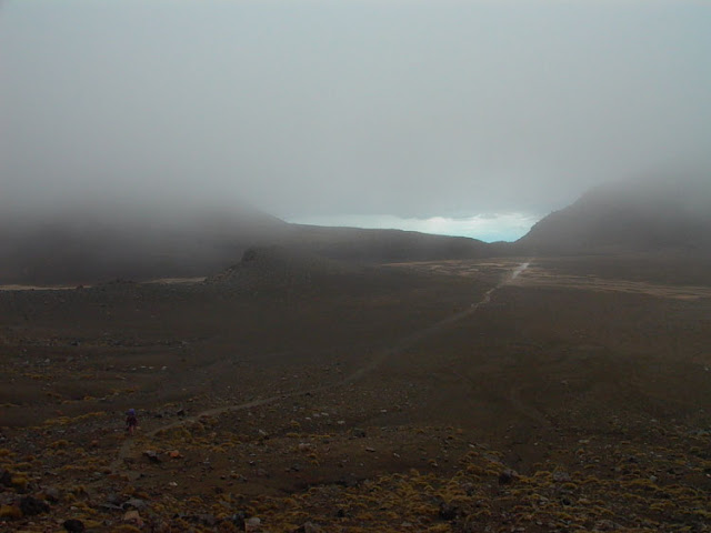
When I got to the top of the 'devils staircase' [ which has been modified recently ] things were very misty .
That's a view looking back to the top of the first climb when you start walking across the crater . Then you start climbing to the Red Crater - this time it was through the mist .
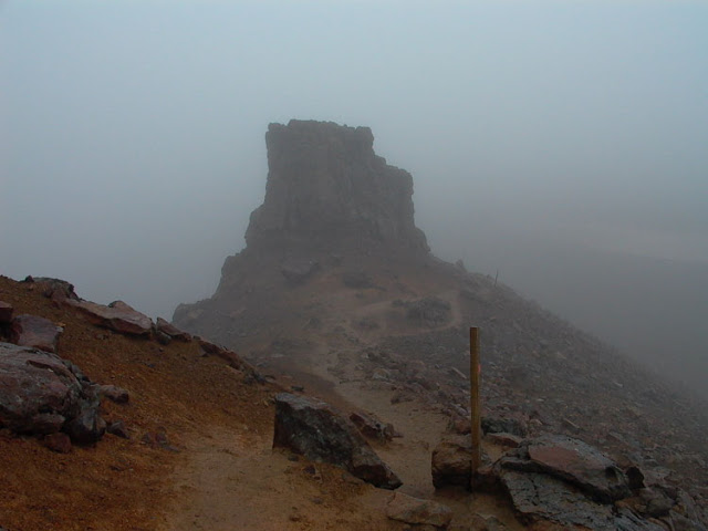
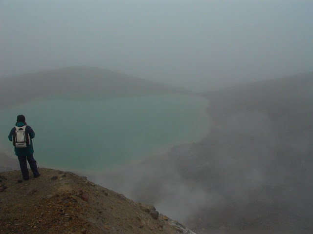
After the Red Crater you work your way down to the emerald lakes .
As I kept moving it was so misty that I never even noticed Blue lake when I walked past it - I have pictures of it in my later expeditions , including some in the snow .
After the Blue lake you start working your way down to the Ketetahi hut .
The scenery is quite good there but the walk down that hill is long and tedious . It is a total of 19.5 km long but that last bit gets you - steps and downhill for 1 1/2 hours [ Last time I ran it in 48 minutes but I had a 15 kg pack ] You go past the Ketetahi springs on the way down - don't drink that water . You are also not allowed near the springs , it is Maori land .
Going back through the bush can be pleasant after a hot day on top , but makes no difference on a misty day .
As the day wears on the bodies start lining up under the shelter .
Back then there was still a guy in an old truck that used to turn up and sell hot dogs and coffee and cool-drinks and pies and the people all swarmed toward him as he popped out the sign advertising food . Apparently he was told he couldn't do it any more but it sure was handy !